High quality aerial imaging
Mapping - ortho-rectified photos of extended areas, much higher resolution than Google Earth
Asset and property inspection, property promotion, Real estate
Environmental, agricultural, architectural
Feral animal surveys and spotting
Insurance claim evidence
3-D models, large and small
An image or video to spruce up your online presence!
20 Megapixel stills, HD time-lapse, video up to 4K 30fps, 2.7K 60fps, or 1.9K slo-mo
Our drone goes Over The Top, so that you don't have to!
A slump occurred at Dungowan on 30/9/2022, the new geography shown here as a digital terrain model

Slump on the left, while the small black dots enclose the area of an old slump from a few decades ago
Click on the image for a fly-around of the 3D model
3D textured models - 2 views


Orthophoto of the slump

Cropped orthophoto, showing details such as water seepage at the top end of the slump, click image for an animated fly-over of the 3D model

Digital Surface Model to show drainage and elevations

Digital Terrain Model removes most above-surface features to show the land surface

Orthophoto - map of the same area above

Orthophoto - map. Detail from a small part of the gully shown in the models and orthophoto above

Digital Elevation Models of a road with potholes and corrugations, with low vegetation on either side


3D modelling
Abandoned >100 year old house in Calala.
After loading, set Z axis as up vector, use both mouse buttons and scroll wheel to manoeuvre and zoom the model

3D model animations
Road surface subsidence due to poor drainage, Monteray Rd, Loomberah
Click the images below to see 3D model fly-over animations


Eroded ground

Romanesco


Dinosaur gourd

Volcanic rock, Garrawilla, NSW

Datura stramonium or Jimson Weed

----------------------------------------------------------------------------------------------------------------------------------------------------------------------------------------------------------------


Fly-through of a gully, Lambruk Creek Loomberah - click on the image

Upper Lambruk Creek area orthophoto, potentially the site of a new solar farm

Lambruk Creek Digital Terrain Model
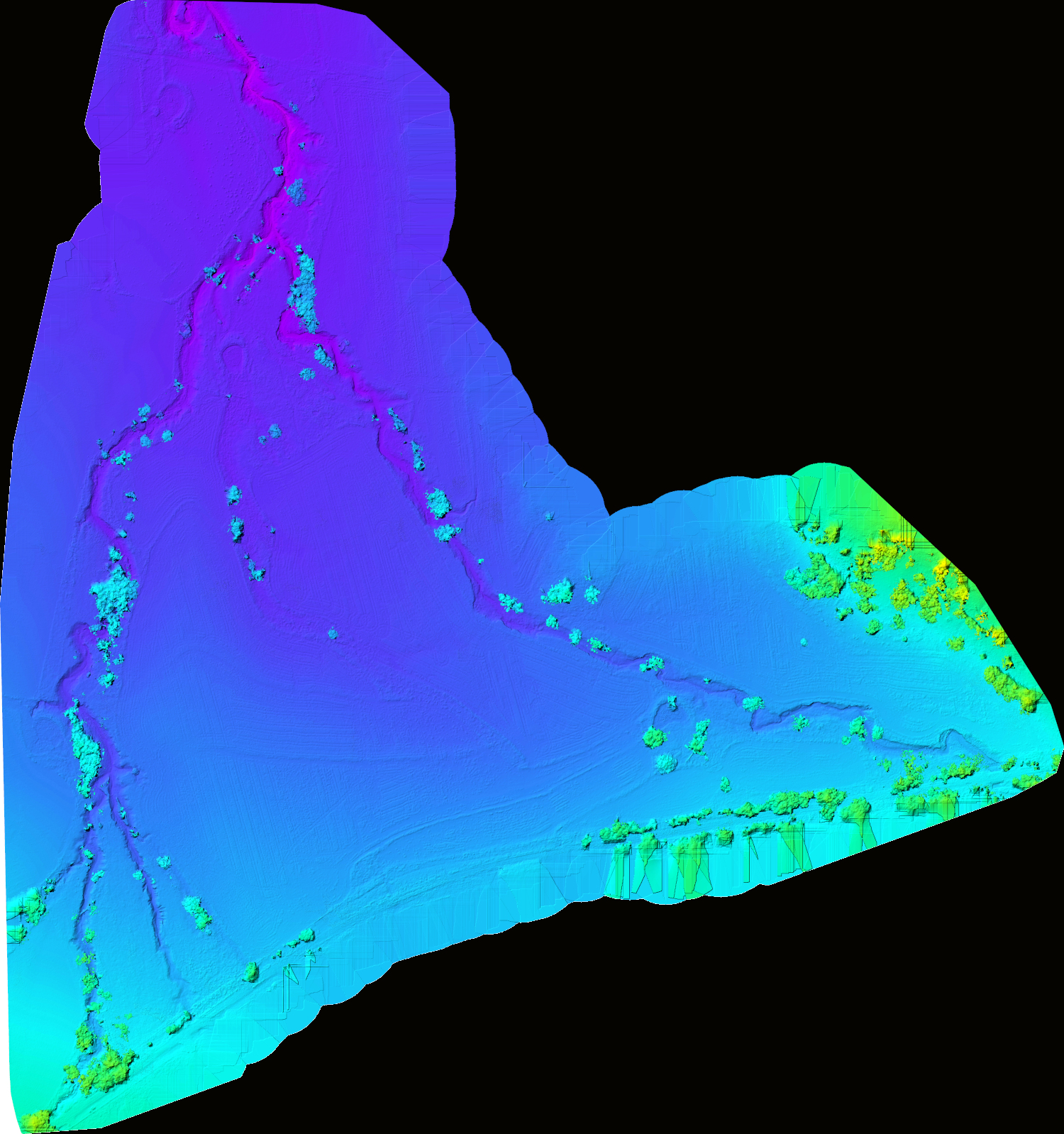
Lambruk Creek Digital Surface Model
------------------------------------------------------------------------------------

Feral pigs - proving shooter assistance by locating them from above


OTT Drones is based in Loomberah, NSW, near Tamworth, operating in the New England and North West, and Upper Hunter region
OTT Drones does not conduct surveillance on people, we have neither the equipment nor desire for that activity